wiki.Ömans.se

Sockenkatalog för släktforskare

Användarverktyg

Webbverktyg


plats:us:sonoma.ca.county

Sonoma (CA) county

Sonoma County är ett county i Kalifornien i delstaten USA. Administrativ huvudort (county seat) är Santa Rosa.

Översikt

sigill

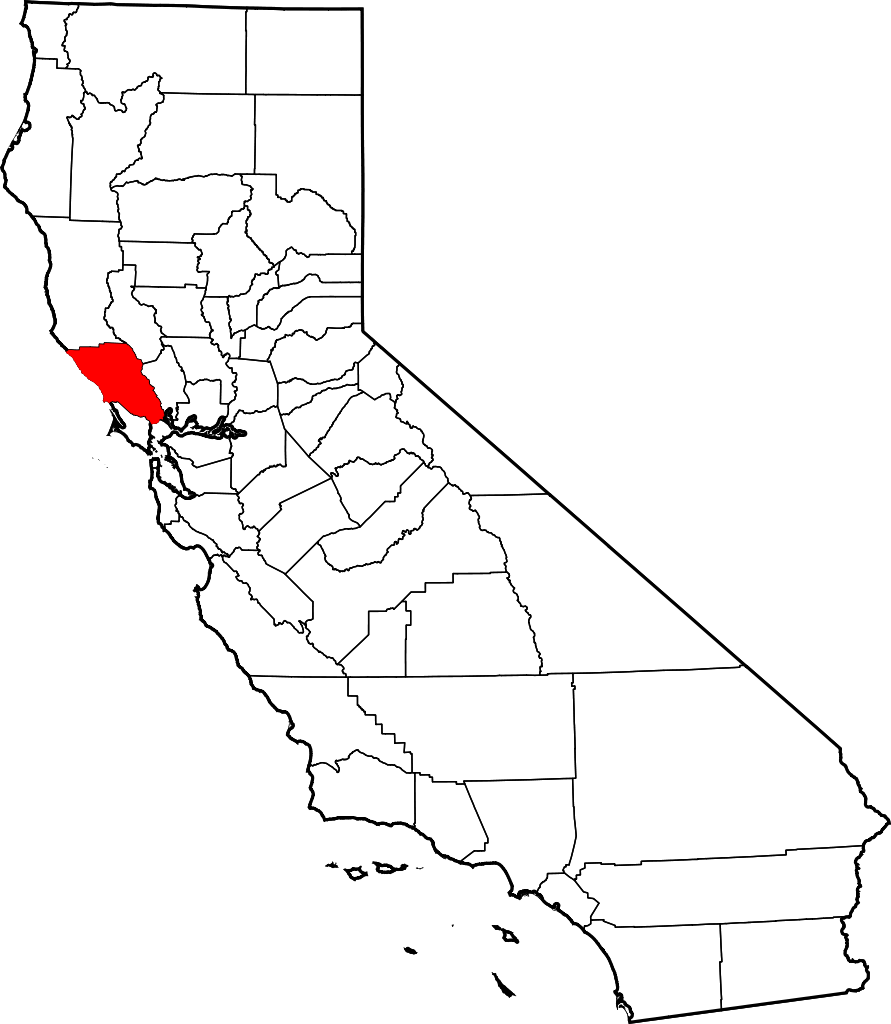
Sonoma County i Kalifornien i USA

Arkiv: United_States_Genealogy
Länk:
Alias:

Historik

BC
The Pomo, Coast Miwok and Wappo peoples were the earliest human settlers of Sonoma County, between 8000 and 5000 BC, effectively living within the natural carrying capacity of the land. Archaeological evidence of these First people includes a number of occurrences of rock carvings, especially in southern Sonoma County; these carvings often take the form of pecked curvilinear nucleated design.
1500-tal
Spaniards, Russians, and other Europeans claimed and settled in the county from the late 16th to mid-19th century, seeking timber, fur, and farmland. The Russians were the first newcomers to establish a permanent foothold in Sonoma County, with the Russian-American Company establishing Fort Ross on the Sonoma Coast in 1812. This settlement and its outlying Russian settlements came to include a population of several hundred Russian and Aleut settlers and a stockaded fort with artillery. However, the Russians abandoned it in 1841 and sold the fort to John Sutter, settler and Mexican land grantee of Sacramento.
1823-
The Mission San Francisco Solano, founded in 1823 as the last and northernmost of 21 California missions, is in the present City of Sonoma, at the northern end of El Camino Real. El Presidio de Sonoma, or Sonoma Barracks (part of Spain's Fourth Military District), was established in 1836 by Comandante General Mariano Guadalupe Vallejo. His duties included keeping an eye on the Russian traders at Fort Ross, secularizing the Mission, maintaining cooperation with the Native Americans of the entire region, and doling out the lands for large estates and ranches. The City of Sonoma was the site of the Bear Flag Revolt in 1846.
-1847
Early post-1847 settlement and development focused primarily on the city of Sonoma, then the region's sole town and a common transit and resting point in overland travel between the region and Sacramento and the gold fields to the east. However, after 1850, a settlement that soon became the city of Petaluma began to grow naturally near the farthest navigable point inland up the Petaluma River. Originally a hunting camp used to obtain game to sell in other markets, by 1854 Petaluma had grown into a bustling center of trade, taking advantage of its position on the river near a region of highly productive agricultural land that was being settled. Soon, other inland towns, notably Santa Rosa and Healdsburg began to develop similarly due to their locations along riparian areas in prime agricultural flatland. However, their development initially lagged behind Petaluma which, until the arrival of railroads in the 1860s, remained the primary commercial, transit, and break-of-bulk point for people and goods in the region. After the arrival of the San Francisco and North Pacific Railroad in 1870, Santa Rosa began to boom, soon equalling and then surpassing Petaluma as the region's population and commercial center. The railroad bypassed Petaluma for southern connections to ferries of San Francisco Bay.

Övrigt

Six nations have claimed Sonoma County from 1542 to the present

består av

Incorporated

Sonoma County has nine incorporated municipalities.

Incorporated communities Population Incorporation Date
City of Cloverdale 8,618 February 28, 1872
City of Cotati 7,265 July 16, 1963
City of Healdsburg 11,254 February 20, 1867
City of Petaluma 57,941 April 12, 1858
City of Rohnert Park 40,971 August 28, 1962
City of Santa Rosa 167,815 March 26, 1868
City of Sebastopol 7,379 June 13, 1902
City of Sonoma 10,648 September 3, 1883
Town of Windsor 26,801 July 1, 1992

Unincorporated

The county also includes the following populated places which are not incorporated:

Census-designated places

  • Bloomfield
  • Bodega
  • Bodega Bay
  • Boyes Hot Springs
  • Carmet
  • Cazadero
  • El Verano
  • Eldridge
  • Fetters Hot Springs-Agua Caliente
  • Forestville
  • Fulton
  • Geyserville
  • Glen Ellen
  • Graton
  • Guerneville
  • Jenner
  • Kenwood
  • Larkfield-Wikiup
  • Monte Rio
  • Occidental
  • Penngrove
  • Roseland
  • Salmon Creek
  • Sea Ranch
  • Sereno del Mar
  • Sonoma State University
  • Temelec
  • Timber Cove
  • Valley Ford

Other unincorporated places

  • Annapolis
  • Asti
  • Camp Meeker
  • Carneros
  • Duncans Mills
  • Freestone
  • The Geysers
  • Guernewood Park
  • Hacienda
  • Kellogg
  • Korbel
  • Lakeville
  • Lytton
  • Mark West
  • Mark West Springs
  • Mercuryville
  • Mesa Grande
  • Rio Nido
  • Schellville
  • Stewarts Point
  • Two Rock
  • Venado
  • Villa Grande
  • Vineburg

Former townships

At the time of its formation, the county comprised four civil townships. It was restructured several times, and by 1880 was made up of 14 townships:

  • Analy
  • Bodega
  • Cloverdale
  • Knight's Valley
  • Mendocino
  • Ocean
  • Petaluma
  • Redwood
  • Russian River
  • Salt Point
  • Santa Rosa
  • Sonoma
  • Vallejo
  • Washington
plats/us/sonoma.ca.county.txt · Senast uppdaterad: 2024/04/03 01:27 av 127.0.0.1