wiki.Ömans.se

Sockenkatalog för släktforskare

Användarverktyg

Webbverktyg


plats:us:polk.wi.co
Geotag (location) for:
Polk co45º27'12.774"N;92º27'23.148"W

Polk (WI) county

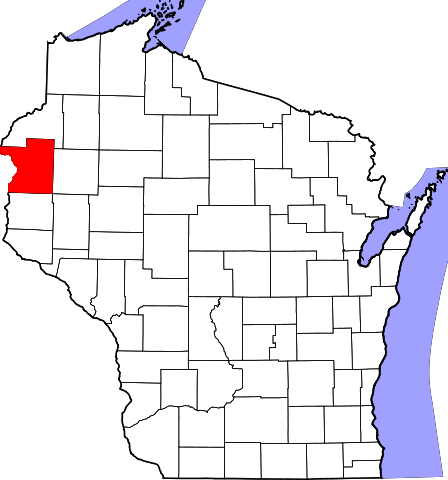
Polk County är ett administrativt område i delstaten Wisconsin, USA. År 2010 hade countyt 44 205 invånare. Den administrativa huvudorten (county seat) är Balsam Lake.

, ,

Översikt

Historik

The county was created in 1853 and named for United States President James K. Polk.

Övrigt

The county was created in 1853 and named for United States President James K. Polk.

består av

Cities

Villages

  • Balsam Lake (county seat)
  • Centuria
  • Clayton
  • Clear Lake
  • Dresser
  • Frederic
  • Luck
  • Milltown
  • Osceola
  • Turtle Lake (mostly in Barron County)

Towns

  • Alden
  • Apple River
  • Balsam Lake
  • Beaver
  • Black Brook
  • Bone Lake
  • Clam Falls
  • Clayton
  • Clear Lake
  • Eureka
  • Farmington
  • Garfield
  • Georgetown
  • Johnstown
  • Laketown
  • Lincoln
  • Lorain
  • Luck
  • McKinley
  • Milltown
  • Osceola
  • St. Croix Falls
  • Sterling
  • West Sweden

Census-designated place

  • Lewis

Unincorporated communities

  • Atlas
  • Bunyan
  • Clam Falls
  • Cushing
  • Deronda
  • East Farmington
  • Eureka Center
  • Fox Creek
  • Horse Creek
  • Indian Creek
  • Joel
  • Lamar
  • Little Falls
  • Lykens
  • McKinley
  • Nye
  • Pole Cat Crossing (partial)
  • Range
  • Richardson
  • Sand Lake
  • Ubet
  • Wanderoos
  • West Denmark
  • West Sweden
  • Wolf Creek
plats/us/polk.wi.co.txt · Senast uppdaterad: 2024/04/03 01:27 av 127.0.0.1