wiki.Ömans.se

Sockenkatalog för släktforskare

Användarverktyg

Webbverktyg


plats:us:clay.mn.co

Clay (MN) county

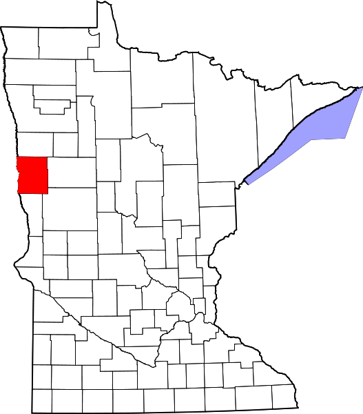
Clay County är ett administrativt område i delstaten Minnesota i USA, med 58 999 invånare. Den administrativa huvudorten (county seat) är Moorhead.

Översikt

Historik

The county was formed on March 8, 1862, although its government was not organized at that time. In 1872, the organization was effected. The county was originally called Breckenridge, but soon (in 1862) was changed to Clay.

Övrigt

It was named for nineteenth-century political figure Henry Clay, member of the United States Senate from Kentucky, and US Secretary of State.

Plats

består av

  • City
    • Barnesville
    • Comstock
    • Dilworth
    • Felton
    • Georgetown
    • Glyndon
    • Hawley
    • Hitterdal
    • Moorhead (county seat)
    • Sabin
    • Ulen
  • CDP
    • Baker
    • Oakport 1)
  • Unincorporated
  • Township
    • Alliance Township
    • Barnesville Township
    • Cromwell Township
    • Eglon Township
    • Elkton Township
    • Elmwood Township
    • Felton Township
    • Flowing Township
    • Georgetown Township
    • Glyndon Township
    • Goose Prairie Township
    • Hagen Township
    • Hawley Township
    • Highland Grove Township
    • Holy Cross Township
    • Humboldt Township
    • Keene Township
    • Kragnes Township
    • Kurtz Township
    • Moland Township
    • Moorhead Township
    • Morken Township
    • Oakport Township
    • Parke Township
    • Riverton Township
    • Skree Township
    • Spring Prairie Township
    • Ulen Township
    • Viding Township

1) part of Moorhead since 2015
plats/us/clay.mn.co.txt · Senast uppdaterad: 2024/04/03 01:27 av 127.0.0.1