wiki.Ömans.se

Sockenkatalog för släktforskare

Användarverktyg

Webbverktyg


plats:us:blue-earth.mn.county
Geotag (location) for:
Blue Earth co44º1'48"N;94º3'36"W

Blue Earth (MN) county

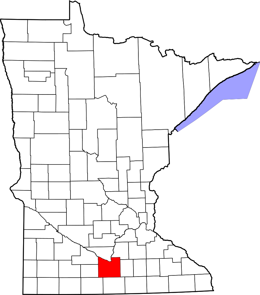
Blue Earth County är ett administrativt område i delstaten Minnesota, USA, med 64 013 invånare. Den administrativa huvudorten (county seat) är Mankato.

Översikt

Historik

The area of Blue Earth County was once occupied by the Dakota Indians. French explorer Pierre-Charles Le Sueur was an early explorer in this area, arriving where the Minnesota and Blue Earth rivers meet. He made an unsuccessful attempt to mine copper from the blue earth. The area remained under French control until 1803 when it passed to the United States in the Louisiana Purchase.

1849-
When Minnesota became a territory, the territorial government became interested in settling the river valley. In 1850 the first steamboat trip, starting in St. Paul, traveled on the Minnesota River and came to the Blue Earth River. The first Euro-American settlers, P. K. Johnson and Henry Jackson, debarked and settled in present-day Mankato. The ratification of the Mendota and Traverse des Sioux treaties in 1851 effectively forced the eastern Dakota to move to nearby reservations.
1853-03-05
The county of Blue Earth was created after a division of the Minnesota Territory, from portions of Dakota County and free territory. The first government officials were appointed by Alexander Ramsey, the territorial governor. That October the first election was held, with 22 ballots being taken.
1855-02-07
the Winnebago (Ho-Chunk) ceded 897,900 acres of their reservation near Long Prairie in exchange for 200,000 acres on the Blue Earth River. On May 24, 1855, they relocated and became so successful at farming that neighboring American settlers coveted their land (eftertraktade deras mark).
  • Blue Earth County is near the Lower Sioux reservation, which was created in 1858. Starvation on the reservation and the lack of timely arrival of government annuities led to the Dakota War of 1862, followed by removal of all Native Americans from the county. In 1868 the railroad's arrival promoted the county's growth and development by bringing immigrants and goods to the area.

Övrigt

It was named for the Blue Earth River.

består av

Cities

  • Amboy
  • Eagle Lake
  • Good Thunder
  • Lake Crystal
  • Madison Lake
  • Mapleton
  • Minnesota Lake (partial)
  • North Mankato (partial)
  • Pemberton
  • Saint Clair
  • Skyline
  • Vernon Center

Census-designated place

  • Garden City

Unincorporated communities

  • Cambria
  • Marysburg
  • Perth
  • Smiths Mill

Townships

  • Beauford Township
  • Butternut Valley Township
  • Cambria Township
  • Ceresco Township
  • Danville Township
  • Decoria Township
  • Garden City Township
  • Jamestown Township
  • Judson Township
  • Le Ray Township
  • Lime Township
  • Lincoln Township
  • Lyra Township
  • Mankato Township
  • Mapleton Township
  • McPherson Township
  • Medo Township
  • Pleasant Mound Township
  • Rapidan Township
  • Shelby Township
  • South Bend Township
  • Sterling Township
  • Vernon Center Township
plats/us/blue-earth.mn.county.txt · Senast uppdaterad: 2024/04/03 01:27 av 127.0.0.1