wiki.Ömans.se

Sockenkatalog för släktforskare

Användarverktyg

Webbverktyg


plats:us:allegheny.pa.county

Detta är en gammal version av dokumentet!


Allegheny (PA) county

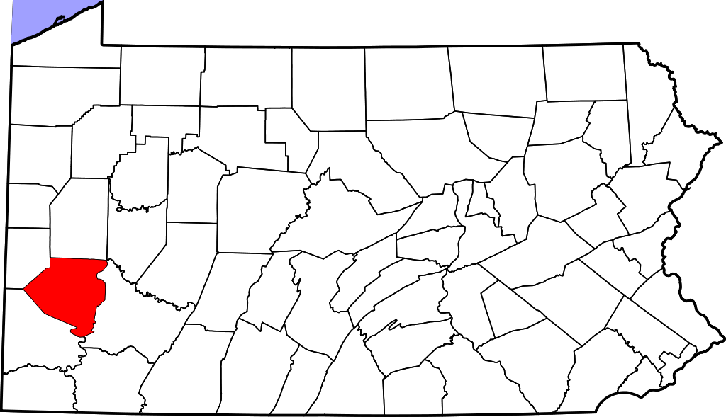
Allegheny County är ett administrativt område i delstaten Pennsylvania i USA, med 1 223 348 invånare. Den administrativa huvudorten (county seat) är Pittsburgh.

Översikt

Historik

Prior to European contact, this area was settled for thousands of years by succeeding cultures of indigenous peoples. During the colonial era, historic native groups known by the colonists to settle in the area included members of western nations of the Iroquois, such as the Seneca; the Lenape, who had been pushed from the East by European-American settlers; the Shawnee, who also had territory in Ohio; and the Mingo, a group made up of a variety of peoples from more eastern tribes.

European fur traders such as Peter Chartier established trading posts in the region in the early eighteenth century.

Övrigt

Allegheny was the first county in Pennsylvania to be given a Native American name. It was named after the Lenape word for the Allegheny River. The meaning of ”Allegheny” is uncertain. It is usually said to mean ”fine river”. Stewart says that the name may come from a Lenape account of an ancient mythical tribe called ”Allegewi”, who lived along the river before being taken over by the Lenape.

består av

Cities

  • Clairton
  • Duquesne
  • McKeesport
  • Pittsburgh (county seat)

Boroughs

  • Aspinwall
  • Avalon
  • Baldwin
  • Bell Acres
  • Bellevue
  • Ben Avon
  • Ben Avon Heights
  • Bethel Park
  • Blawnox
  • Brackenridge
  • Braddock
  • Braddock Hills
  • Bradford Woods
  • Brentwood
  • Bridgeville
  • Carnegie
  • Castle Shannon
  • Chalfant
  • Cheswick
  • Churchill
  • Coraopolis
  • Crafton
  • Dormont
  • Dravosburg
  • East McKeesport
  • East Pittsburgh
  • Edgewood
  • Edgeworth
  • Elizabeth
  • Emsworth
  • Etna
  • Forest Hills
  • Fox Chapel
  • Franklin Park
  • Glassport
  • Glenfield
  • Glen Osborne
  • Green Tree
  • Haysville
  • Heidelberg
  • Homestead
  • Ingram
  • Jefferson Hills
  • Leetsdale
  • Liberty
  • Lincoln
  • McDonald (mostly in Washington County)
  • McKees Rocks
  • Millvale
  • Monroeville
  • Mount Oliver
  • Munhall
  • North Braddock
  • Oakdale
  • Oakmont
  • Pennsbury Village
  • Pitcairn
  • Pleasant Hills
  • Plum
  • Port Vue
  • Rankin
  • Rosslyn Farms
  • Sewickley
  • Sewickley Heights
  • Sewickley Hills
  • Sharpsburg
  • Springdale
  • Swissvale
  • Tarentum
  • Thornburg
  • Trafford (mostly in Westmoreland County)
  • Turtle Creek
  • Verona
  • Versailles
  • Wall
  • West Elizabeth
  • West Homestead
  • West Mifflin
  • West View
  • Whitaker
  • White Oak
  • Whitehall
  • Wilkinsburg
  • Wilmerding

Townships

  • Aleppo
  • Baldwin
  • Collier
  • Crescent
  • East Deer
  • Elizabeth
  • Fawn
  • Findlay
  • Forward
  • Frazer
  • Hampton
  • Harmar
  • Harrison
  • Indiana
  • Kennedy
  • Kilbuck
  • Leet
  • Marshall
  • McCandless
  • Moon
  • Mt. Lebanon
  • Neville
  • North Fayette
  • North Versailles
  • O'Hara
  • Ohio
  • Penn Hills
  • Pine
  • Reserve
  • Richland
  • Robinson
  • Ross
  • Scott
  • Shaler
  • South Fayette
  • South Park
  • South Versailles
  • Springdale
  • Stowe
  • Upper Saint Clair
  • West Deer
  • Wilkins

Census-designated places

Census-designated places are geographical areas designated by the US Census Bureau for the purposes of compiling demographic data. They are not actual jurisdictions under Pennsylvania law. Other unincorporated communities, such as villages, may be listed here as well.

  • Allison Park
  • Bairdford
  • Bakerstown
  • Boston
  • Carnot-Moon
  • Clinton
  • Curtisville
  • Enlow
  • Gibsonia
  • Glenshaw
  • Greenock
  • Harwick
  • Imperial
  • Noblestown
  • Rennerdale[42]
  • Russellton
  • Sturgeon

Unincorporated communities

  • Acmetonia
  • Blackridge
  • Blanchard
  • Broughton
  • Bruceton
  • Buena Vista
  • Creighton
  • Cubbage Hill[42]
  • Cuddy[43]
  • Dorseyville
  • Ewingsville[42]
  • Harmarville
  • Indianola
  • Ingomar
  • Karns
  • Keown Station
  • Kirwan Heights[42]
  • Library
  • McKnight
  • Moon Run
  • Mount Vernon
  • Natrona
  • Natrona Heights
  • Nevillewood[42]
  • Presto[42]
  • Regent Square
  • Rural Ridge
  • Sheraden[44]
  • Warrendale
  • Wexford
  • Wildwood
plats/us/allegheny.pa.county.1706138251.txt.gz · Senast uppdaterad: 2024/04/03 01:20 (extern redigering)