plats:ca:andrew-saint.mb.kn
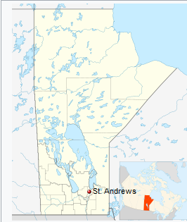
Andrew S:t (MB) municipalitySt. Andrews is a rural municipality in Manitoba, Canada. It lies west Red River; its southern border is approximately 8 kilometres (5.0 mi) north of Winnipeg. ÖversiktHistorikSince the Red River was an important means of transportation in the early settlement and parish, much of St. Andrews' history can be seen along River Road. The parish of St. Andrews was situated between two major fur trading centers of the Hudson's Bay Company, Lower Fort Garry (near present-day Selkirk) and Upper Fort Garry (located in present-day Winnipeg). ÖvrigtThe name St. Andrews was derived from the Anglican parish of St. Andrews, which existed for several decades prior to the formation of the municipality in February 1880. |
Platsbestår av
Smaller communities
|
plats/ca/andrew-saint.mb.kn.txt · Senast uppdaterad: 2024/04/03 01:27 av 127.0.0.1
