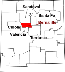
Bernalillo (NM) countyÖversiktHistorikBernalillo County är ett administrativt område i delstaten New Mexico, USA, med 662 564 invånare. Den administrativa huvudorten (county seat) är Albuquerque, den största i New Mexico. Rio Grande löper tvärs igenom staden från norr mot söder, och staden gränsar i öster till bergskedjan Sandia Mountains på en höjd av 3 255 m. Bernalillo County was one of seven partidos established during Mexican rule; in 1852, within two years of the creation of the New Mexico Territory, Bernalillo became one of that territory's nine original counties. In 1876, it absorbed Santa Ana County. In 1906, years after the Land Revision Act of 1891 provided for the setting aside of forest reserves, the parts of Bernalillo County currently known as Cibola National Forest were established as reserves. USS LST-306, a World War II tank landing ship which participated in the Allied invasion of Italy, was renamed USS Bernalillo County in 1955. Sandia Mountain Wilderness was created in 1978 and the Petroglyph National Monument was established in June 1990. Övrigt |
Platsbestår av
|
Användarverktyg
plats:us:bernalillo.nm.co
plats/us/bernalillo.nm.co.txt · Senast uppdaterad: 2024/04/03 01:27 av 127.0.0.1


